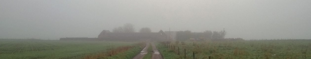
We are in a bit of a pattern of work now. We are up and about shortly after 8am and out by 9am. We work through the day taking lunch between 2 & 3 pm, then an afternoon shift until 6-8pm. Now it is light until 11pm, we have done a few evening shifts as well until 10-11pm. Saturday mornings Jill usually does Parkrun in Ellon, I do the weekly shop and we get back about 11am. Sundays we take turns with Jills parents and her sister/brother-in-law, cooking an evening meal. We borrow a kitchen when it is our turn, the caravan is not really equipped for such things. Of course we do sometimes venture out into the wider world, to collect building materials, to visit garden open days or to go to garden centres. The latter two usually with Jill’s parents.
Category Archives: About
Getting ready to move up to Aberdeenshire!
Andy retires on 5th April 2019, our house is on the market (but probably awaiting the outcome of the big ‘B’) and we are winding down after rather more than 34 years living in Suffolk. We will stop off in Manchester, where Jill will run her first marathon. The following day we drive up to Aberdeen.
We have booked a luton van to get the next lot of stuff up to Aberdeen. Mostly into next-door’s big shed to be precise. The load we took up over Christmas was a long-wheel-base panel van and seemed pretty vast, but we still have a lot more to move. It has nominally double the packing space. We looked at a 7.5 tonne truck to do a single move but they are disproportionately expensive – much cheaper to hire two luton vans. So we will do a run up from Suffolk in mid-March and will hire another van in Aberdeen for early April to do a run down to Suffolk. Any stuff left over will have to stay until we have sold the house.
We have a list of 77 organisation to contact to either cancel services from, or to change our address. We expect not to have a BT landline for a while, so we will lose out BTinternet email addresses after 60 days.
The view from space
I occasionally check on public websites that show satellite imagery, looking for up-to-date views of our patch. I was looking on a NOAA site and saw, for the first time, that our handiwork has been viewed from space. Checking more widely, I saw that ESRI publish the same imagery and allows me to zoom in closer. The quality is not great (I think it is the 2.5m SPOT Imagery). Below, I have included 1) the current Bing Maps view which is good quality, but out of date and 2) the new image.


When was the newer image taken?
Having found the image I could see that our caravan was where it was first parked up, so was post March 2016, but that the last piece of concrete silage-pit wall, to the right of the steading, was still in place so was pre-September 2016. We had not started the foundations or drains and the hedging had greened up, so I speculated June give or take a month. When I checked the ESRI feed, it said May 2016, so I was just about right.
What can we see?
- Most obviously, the adjacent property has had all old buildings, including the farmhouse, demolished. The new holiday let is on the southern edge of that property and the over-large garage is very much in our line of site. We planted hedging and a number of trees right on our boundary and they will eventually screen most of it. We have not yet planted up the section closest to our west wing because we are still re-building the gable-end.
- The roof on the steading and the south-west gable-end have gone, but the concrete wall across the courtyard and broken hard standing are clearly visible.
- The wall to the right of the steading, in-line with the north wall, is still there. This the last of the walling that made up the silage pit.
- The concrete ramp that runs from the right of the bothy, down to the southern boundary, is still there but getting covered in vegetation.
- The black weed membrane, that we planted our hedging into, shows clearly. It runs from the north-west corner next to our track, across to the north-east corner then south to the silage-pit wall, but is distinctly paler than the rest because it has woodchip mulch on it. From there to the south east corner it is not covered and is darker. There is a gap along most of the southern boundary, but restarts before the south east corner. It then runs north, to the left of the bothy and stops at our biggest pile of granite. The top half of this run is also pale because we spread mulch on it.
- Our north-east corner is a neat right-angle, rather than the awkward bit that poked out into the field, that appeared on our plans. We gave up most of that, but gained a wedge down the east side – the old boundary ran right against the edge of the silage pit wall, it is now several m to the east.
For the record…
Keeping records: I wanted detailed records of our project right from the start. I keep a daily diary of what we do, who we talk/email/text with, the things that go well and the things that go wrong. I record evidence e.g. when I get emails & phone calls, contact details etc., just in case things go awry. It was valuable when we got cheesed off with Barclays back in 2014, when they were not able to get the mortgage on our current house completed to a sensible timescale. I was able to complain, with verifiable facts. It did not speed things up, but was cathartic.
I take loads of photos of every stage of the work – partly for my interest, but mainly so that we can show that we met building standards at every step of the way.
I have a fairly complicated Excel workbook where I keep track of a) the work to be done v what we actually do, b) everything we spend v our estimates, c) the timeline and d) quite a bit of technical information to help us make right decisions. I keep a running total of reclaimable VAT and cross-check this against our collection of paper invoices. Once we get our completion certificate, we will be in a good place to get the VAT back, HMRC permitting.
Social media: Having all this information, we wanted somewhere to let our friends know what we are up to. We use the facebook page https://www.facebook.com/OurNextHouse/ for this. We update this when we are on site and whenever something noteworthy happens. It is very good at what it does, but it is not easy to navigate, it encourages brevity and is more for the moment.
Newsletters: Jill found her library borrowers were interested in the project, but did not necessarily have access to facebook. We create occasional 2-page summaries of progress that we print out for borrowing. The pdfs are on the https://eastbyreleasksteading.wordpress.com/bungay-newsletters/ page of this blog.
Blogging: Having detailed records is good, but it is not easy to pick through it and get a good overview of how we are doing. I wanted somewhere where I could be a bit more reflective, think things out in writing and maintain a sort of official record. So I looked at blogging and already had experience with WordPress. This is where https://eastbyreleasksteading.wordpress.com/ came from. It got off to a patchy start but, as we got working on site, became more useful to me. At the time WordPress had a usable user interface, but some aspects of it were slow, unreliable and downright painful – particularly loading and presenting photos. I also found the free themes rather limiting. It got to the point where I gave up on it in favour of the facebook page because I did not have enough free time.
I missed the blog, as a way of getting a better understanding of what we are doing, and looked for a more modern environment to work in. I chose Wix. It serves the same purpose as WordPress, with a more modern interface that streamlines composing and publishing. I quickly got the material transferred across, tidied up my prose and generally enjoyed it a lot more. I expended the scope to include the history of the area. I particularly liked the countdown timer I put on the home page saying how many days left until we move up to Scotland.
What put me off Wix is that it is a resource hog and that the UI is slow and surprisingly flaky – I expect there are endless amounts of JavaScript chuntering away in the background. The blogging plugin also does not include links to previous and next posts in the detailed post page, so I was having to add links manually – not good. Once again the platform became a bit of a barrier. I also thought the hosting was much slower than WordPress, both when composing and when viewing pages. This put me in a dilemma – should I look for yet another blogging platform? I went back to WordPress to see if it was really as clunky as I remembered. And behold! They have streamlined the workflow. Loading photos is easy and they have a nice galleries feature. The site races, both composing and viewing. There are many more free themes and the newer ones are responsive i.e. they work well on my phone as well as my PC. If I had a tablet, it would work well on that!
So I have come home to WordPress. I have experimented with at least three different themes and am just about where I want to be. I have set up my categories to match how we are planning the building work. I have mapped most of the categories to the menu. I have a cruder version of the countdown, showing months left until we move North, not days. I have a monthly calendar & handy tag cloud. The blog shows the most recent 10 posts, with a ‘more posts’ button at the bottom. On my phone it initially displays post titles only, making it as quick and easy to navigate as on my PC. I can be much more efficiently self-indulgent.
The later history of the Gordons of Pitlurg
I came across the short book ‘The Name of Gordon‘ which has the following two pages about the Gordons of Pitlurg. It is somewhat confusing:
The diagram on the first page claims that John Gordon, son of William Skene Cuming Gordon, died in 1828. This must be a mistake, it was his grandfather, John Gordon Cuming Skene, who died in 1828. Elsewhere he is recorded as born 1827 and married for the second time in 1860, with no recorded date of death. His sister, Luckan here, Lucan Gordon Cuming Skene elsewhere, was born in 1832 and did indeed marry William Ross-King of Tertowie. Their son, James Alexander Gordon-King, born 1872, did not have children and died in 1904.
The sequence of events transferring succession from John Gordon, date of death not recorded here, to James Alexander Gordon, born in 1872 is not described.
This account does at least explain why the Leask Estate was claimed to have been broken up and sold off in lots early in the 20th century. One account suggests 1904 or therabouts, another suggests 1921. One account also suggests the lots were sold to tenants, in which case it is not clear when Slains estate acquired them. By 1964, they owned most of the lots, including East Byreleask.


The Gordons of Pitlurg
Here are scans of part of ‘A genealogical and heraldic history of the commoners of Great Britain and Ireland’ by John Burke (as in Burke’s Peerage). They relate to the Gordons of Pitlurg, who acquired the Leask estate in 1731, by James Gordon of Hilton marrying Barbara Cuming (mentioned near bottom of first column on page 49). Their son, James Gordon Cuming of Pitlurg, inherited in his own name on the death of his mother. The very last paragraphs associate the rise in the fortunes of the family from the acquisition of Leask, Birness & Skene estates.
The subject of the genealogical entry is Colonel William Skene Cuming Gordon and notes that his eldest son, John, was born 9th Feb 1827.
There is pleasing speculation at the beginning about the origin of the Gordon name, which so dominated this area of Scotland.


Slains Parish in the 1950s
I have copied this from the very useful website run by Ray Leask. It includes this sentence “The small estate of Pitlurg, formerly called Leask, and owned at one time by the Gordons of Pitlurg in Banffshire, was sold in lots some 50 years ago; the small mansion house, built in 1828, was burned down in 1927.”
East Byreleask must have been one of the lots sold to the Slains Estate early in the 20th century.
—————————————————————————————————————————
The Parish of Slains
by Rev. John Murray, M.A. with a contribution on Birds by Dr. H. Edgar Smith, Newburgh
Physical Basis. The parish, situated in the south-east corner of Buchan, is triangular in shape. It is bounded on the east by the North Sea, on the south-west by the estuary of the River Ythan and its tributary, the burn of Forvie, and on the north-west by a line running from a point on the Ellon-Peterhead road at Pitlurg, to the sea at Ogston. Slains thus marches with the parishes of Foveran on the south and south-west, Logie-Buchan on the west, and Cruden on the north. It stretches for nearly 7 miles along the coast and over 4 miles inland at its broadest point and has an area of 9,154 acres.
There is one village, Collieston, in a small bay about midway along the coast. Slains is an exposed, almost treeless parish, but the scenery is by no means uninteresting, with the contrasting views of rocky coast, sandy wastes, and rich green grass, laced by small lochs and the waters of the Ythan, while from the high ground the eye travels far out to sea, south to Aberdeen and Girdleness, and inland, over the fair lands of Formartine to Bennachie and the Highlands of Aberdeenshire and Kincardineshire. The Slains caves, Cave Arthur, the Dropping Cave, Hell’s Lum and others, are now little visited, partly owing to lack of interest; and possibly also because falls of rock have blocked the passages to the inner chambers. The Needle’s Eye, a narrow chasm about 30 yards in length and 30 feet in height, which pierces a mass of rock with a grassy top, lends picturesqueness to the bay of Cransdale and in winter acts as a funnel for the ejection of clouds of wind-blown spume. Cransdale was known to older fishermen as St. Arnan’s Haven, or Tarn’s Haven, a corruption of St. Teman’s Haven.
While the district of Buchan is generally typified by its granite, none is found in Slains; the underlying rocks are mica-schists, overlaid by red boulder clay, moss and sand, with alluvial deposits alongside the Ythan and the small burns. A belt of loamy soil, averaging one mile wide, runs from north to south in the centre of the parish, and light sandy soil skirts the Forvie sands.
The parish has four main features, the Sands of Forvie, the farmlands of Slains, the Moss of Lochlundie, and the coastline and village of Collieston.
The Sands of Forvie, covering over 1,500 acres and comprising most of the old parish of Forvie, stretch from the mouth of the Ythan, along the northern shore of the estuary for about two miles, and northwards for about three miles, almost to the village of Collieston. This tumbled waste of wind-blown sand has sand hills over 100 feet above sea level, and rises at its highest point to 184 feet. Three small lochs, all approximately 100 feet above sea level, border the sands on the north, and probably owe their formation to them; they are Sand Loch (11 acres) just south of Collieston, Cotehill (12 acres) about I mile to the west, and between them, Little Loch (21 acres). It is clear that the sands have reached their present extent only after centuries of encroachment. There may have been periods, after an uplifting of the east coast of Aberdeenshire in the fifteenth century, when severe storms brought sudden destruction; tradition mentions two such storms, one which visited Aberdeen and the adjacent coasts on 10 August 1413, and the other of nine days’ duration in 1688. It seems probable that much of Forvie parish had been overblown with sand by the time of the Reformation. There is no record of the date when Forvie was conjoined to Slains, but there was no designation of a Forvie glebe and no appointment of a minister to Forvie parish alone, after the Reformation. The union may have been made by the Commission which was appointed by Act of Parliament in 1617, “to unite sik Kirks, ane or moe as may conveniently be unite.” The sand was still encroaching on the agricultural land to the north as late as the middle of the eighteenth century, for reference is made in a case of arbitration between King’s College, as titulars of the teinds, and the Earl of Erroll, proprietor, to a reduction of rent granted to Alexander Thoirs in Whiteness Mains of Collieston and Cotehill ” upon account of the damage done to his possession by sandings.” Although strong winds may still raise a minor sand storm, there seems little likelihood of any further encroachment, as even the highest sand hills (apart from a few very ancient hills by the mouth of the Ythan) are partly covered by bent, and the lower parts are largely clad with scrubby heath and heather. Bilberry is plentiful, and in the boggy patches there are reeds, willows and water-ranunculus while in spring and summer, primroses, cowslips, ragged-robins, orchids and the Scottish bluebell cause the desert to rejoice; in sheltered hollows by the sea the lovely grass of Parnassus is to be found.
The village of Forvie stood about two miles south of Collieston and half a mile inland. The foundations of the Kirk of Forvie (said to have been built by St. Ninian) are still to be seen among the sand hills. Nearby are St. Ninian’s Well and burn, and also a salmon bothy said to have been built with stones filched from the ruins of Forvie Kirk.
Of recent years there has been a renewal of interest in the Forvie sands and they are at present the subject of study by members of the geography and botany departments of Aberdeen University. The shifting of the sands near the estuary has revealed remains of stone circles and burial sites on a raised beach. To many the most interesting feature of the Forvie sands and the surrounding district is the bird life, and the following account is supplied by Dr. H. Edgar Smith, New- burgh: The sands of Forvie, the north bank of the Ythan estuary, and the adjoining small lochs have been for many years a bird sanctuary, where, until recently, there has been a watcher, appointed by the Royal Society for the Protection of Birds. In this desolate waste, eiderduck, both resident and visiting, attracted by the mussel beds at the Ythan mouth, nest in enormous numbers; terns, common and arctic, sandwich and little (the two former varieties sometimes in dense colonies) and inland, black-headed gulls, and on the coast herring gulls, occupy the same sites year after year. sheldduck in the rabbit burrows, redshank in the tussocks, ring plovers and oyster catchers in the shingle, and inland, where there are bilberries, heather and mossy patches, grouse, snipe, partridge and curlew nest in varying numbers, while duck (mallard, shoveller and tufted), moorhens, coot, water- rails and mute swans nest near the lochs. Occasionally great crested grebes and greenshanks rear their broods, while along the banks of the Ythan in the heather, nests of meadow pipits, in increasing number, attract the cuckoo. Autumn and winter visitors include green plover and curlew, often in hundreds, dunlin, godwit, knots, kingfishers, cormorants, heron, widgeon, pintail, long-tailed duck, merganser, sander ling, turnstones and purple sandpiper. For countless years the estuary of the Ythan, the adjoining fields and the Meikle Loch of Slains have been a favourite feeding or resting ground for the migrating geese, mostly pinkfoot and grey lag, with occasional Whitefront and Barnacle. Whooper swans rest annually for a day or two in the tidal waters during their northward passage.
Westwards and northwards from the Forvie sands stretch the farmlands of Slains, rising from sea level at the Ythan estuary to a height of 278 feet in the north of the parish. This stretch of exposed country is intensely cultivated, except for some rough ground near the Ythan, the Meikle Loch and Kippet Hills, and the expanse of Lochlundie Moss in the north-west. The Meikle Loch, covering about 70 acres, lies about the centre of the parish, with the grassy Kippet Hills, consisting of glacial debris, rising 50 feet above the north banks and 184 feet above sea level. These hills are interesting as having furnished rounded limestones of a type rare in Scotland. which at one time were burned to provide agricultural lime.
The Moss of Lochlundie lies in the north-west of the parish and covers some 240 acres having formerly been of much greater extent (about 400 acres). In pre-historic days it was a loch, as its name implies, while the high ground at Lochlundie farm was an island. A canoe, with broken oar found seven feet deep in the moss, stone battle axes, flint arrow heads, polished celts, the skeletons of wild ox and deer found in the vicinity are reminders of a vanished life. Of more recent date are the disused peat lairs and the ruins of several dwellings provided by the Parochial Board for the reception of pauper women. One wonders why poor old women were banished to such bare lonely country till it is remembered that some 50 years ago the moss was one of the liveliest places in the parish, during the cutting and drying season, and a dwelling near the moss was the equivalent of a house at the pit-head today.
The coast-line for one-third of its length from the mouth of the Ythan to Hackley Head is low and sandy but thereafter is rocky with cliffs rising to 50 and 100 feet. Those to the south of Collieston and the coasts of Forvie provide the anomalous sight of sand piled on their heads instead of at their feet. The rocks are very hard schists with an eastward dip and as they are impregnated with irregular quartz veins. Erosion has formed chasms and narrow bays with dangerous rocks running out to sea causing many a shipwreck. Several sea caves have been formed their presence being largely responsible for promoting the once flourishing smuggling trade, which had its headquarters at Collieston. There is a beautiful sandy bay at Hackley which can be reached only on foot. The fishing village of Collieston and the Kirkton of Slains cling to the green cliffs which surround the twin bays of Collieston and Cransdale. From the point of the small promontory dividing the bays a pier built in 1894 at a total cost of £6.040 including a grant from the Fishery Board of £4,440, encloses Collieston Harbour. At that date hopes were high in the fishing industry and there was even talk of a branch railway line running to Collieston. Not many years passed however before there was an exodus of the young men from Collieston to join the larger fishing fleets. Small herring boats, which used to join the fishing fleet at Peterhead, afterwards wintering in the estuary of the Ythan became outmoded, and the larger line fishing boats, which required all hands including those of the women, to haul them up the beach became too unwieldy for the few remaining. The population of the village which had risen from 167 in 1840 to 442 in 1871 fell rapidly and today there are only some half-dozen who engage more or less regularly in line fishing during the winter for cod and in summer for haddock and whiting. Lug and mussels for bait are still collected at the Ythan, but no longer are the fishwives seen carrying the heavy creels to and from Collieston. Yet Collieston was not destined to become a deserted village, for other changes occurred to prevent this. The chalybeate springs which once helped to attract visitors may be forgotten, and the harbour wall may be beginning to crumble, but it still furnishes a safe bathing and paddling pool. Many houses which stood derelict for years, or changed hands for as little as £20, have been rebuilt, and are used as summer residences or for holiday lets, while in winter they are occupied by young married couples or others having no permanent home; in the holiday season also tents and caravans appear. There is thus a permanent and a floating population, the winter population, including those in furnished lets, being approximately 160.
Living as they do in isolated communities, fisher-folk, as is well known, cherish tradition and bygone ways of living. It is thus interesting to record that not so many years ago fishermen’s weddings invariably followed a traditional pattern. All those who had been present at the ceremony, and this in fact included practically the whole fishing community, adjourned to the links at the end of Forvie Sands to the strains of a fiddle to dance the intricate Lang Reel of Collieston.” It was begun by the bride and bridegroom, who were followed by pair after pair linking themselves into it, and as in some other dances, pair after pair dropped off, until none were left dancing but the bride and bridegroom who commenced it.
About a mile and a half north of Collieston the ruined tower of old Slains Castle stands unchanged throughout the years, but the fishing hamlet which stands on the promontory at its feet, and which in 1871 had 80 inhabitants, now has two permanent residents.
Place Names. The Rev. James Rust, a former minister of Slains, in his book Druidism Exhumed (1871}, amid much polemical matter concerning the origin of stone circles in Britain, gives many interesting side-lights on the history of Slains and the origin of place names, connecting them with the sacred fires and stones of the Druids. Slains,” he derives, not from the Gaelic word for health as was formerly supposed, but from words meaning, the plain of the Druid Sorcery “Collieston,” the corner of the firebrands “Crawley ” (near Old Slains} the circle of Stones “; and Hackley ” (formerly anglicised to Hawk-la “} the field encircled by stones,” and Cave Arthur,” near Cransdale, the cave of the height of the Druids.” The massive earthwork withholding the tides from the entrance to this cave and the presence of a rude altar or dolmen in the interior point to the unportance of the cave for early inhabitants. Clochtow, a farm within half a mile of the Old Castle, meaning the black stone,” has an interesting story; after the destruction of the castle in 1594, the Countess of Erroll, upon her husband’s flight, retired and was allowed to live in the farmhouse of Clochtow, a sufficiently mean abode, and continued there for some time after 1597, when the honours and estates were restored by the Scots Parliament and the Countess, all her remaining days preferred to her noble title of Countess of Erroll the plain designation of Guidwife of Clochtow.
Session minutes of the year 1649, quoted by Rust show the steps taken to suppress superstitious practices connected with sacred rites and fire-worshipping during Beltane, Yule, Midsummer and Hallowe’en.
Climate. In another book the Rev. James Rust describes the showers of black rain and shoals of pumice stone experienced in Slains in 1861 and 1863, attributing these to an eruption of Vesuvius. The Rev. Gavin Dunn in the New Statistical Account describes the climate of Slains as being damper, colder, and in every respect less genial than in some of the inland parts of the country, and speaks of the failure of an experiment in growing gooseberries and in the planting of trees. It would seem that the climate has moderated somewhat since then, as sheltered gardens, where the heavy soil has been well worked, produce excellent crops of fruit. Dampness there is at times, especially in the gables of houses, but this may be attributed to the use of sea sand in their building. Sycamore trees and others suited to coastal conditions grow more readily, while at Waterside, near the Ythan, there are firs and beeches. The hardwood trees at Pitlurg House have belied the “by no means thriving appearance” attributed to them in the New History of Aberdeenshire (1875) by growing into handsome trees; many unfortunately have long since been cut down. The scene could be beautified and the climate softened by belts of trees judiciously planted, and probably much of Forvie wilderness could be reclaimed, if not for agriculture, at least for woodlands.
Estates. The estate of Slains, which comprises four-fifths of the parish, was sold in 1942 by Mrs. Claeson Gordon of Cluny to Sir Ian Walker of Osmaston Manor and Glenmuick, and forms part of the Walker Scottish Estates. Lately a number of farms on the coast in the north-east of the parish was offered for sale, but only two found buyers. The Countess of Erroll (whose forefathers owned the greater part of the parish, having their seat at old Slains Castle till its destruction by James VI in 1954 (?), when they later built Slains Castle in Cruden) purchased the Old Castle and the promontory on which it stands in 1950. The small estate of Pitlurg, formerly called Leask, and owned at one time by the Gordons of Pitlurg in Banffshire, was sold in lots some 50 years ago; the small mansion house, built in 1828, was burned down in 1927.
Antiquities. The Earls of Erroll with their families, from Andrew, the seventh Earl (1585), to Mary, Countess in her own right (1758), are buried in Erroll’s Aisle in Slains churchyard, which is all that remains of the old Church of St. Ternan. A tombstone often sought 1 out to-day, not for its edifying but for its romantic associations with the days of smuggling, stands opposite the door of the church, and bears the simple inscription: ” In memory of Philip Kennedy, who lived sometime in Ward of Slains, who died the 19th December, 1798 aged 38 years. Kennedy was killed by an exciseman while resisting, arrest during a smuggling expedition; though deserted by his companions and having his head split by a sword, he was able to drag himself a distance of quarter of a mile to Kirkton of Slains, where he died within a few minutes. It is said that the skull of Philip Kennedy, known by the cut from the gauger’s weapon, has been repeatedly turned up in excavating the graves of others of the same name buried here. A novel by John Skelton called The Crooked Meg (1880) embodies the adventures of the Crooked Mary, a lugger engaged in smuggling along the coasts of Slains, Cruden and Peterhead; caches of contrabrand goods were made in the caves and sands. At St. Catharine’s Dub, near Cransdale, lies the wreck of the St. Catharine, said by tradition to have been one of the ships of the Spanish Armada in 1588, though it has been suggested that it was sunk while attempting to deliver cannon prior to the ” Earls’ Rebellion ” in 1594. On various dates in the second half of last century 10 cannon of brass and iron were raised from the wreck, and were distributed, among other places, to Balmoral Castle, Haddo House and the National Service Museum at Whitehall. Until recently the vicinity of the wreck was marked by a rubbish dump. A piscina, found on the site of Forvie Kirk, is now in the National Museum of Antiquities, Edinburgh, while at the manse of Slains is a small octagonal font of granite, which also is said to have been taken from the kirk. The ruin of another interesting antiquity is St. Adamnan’s Chapel, which probably dates from the end of the thirteenth century.
Agriculture. There are 70 holdings of varying size in the parish, one farm is over 600 acres, 10 are between 200 and 300 acres, 14 between 100 and 200 acres, 31 between 20 and 100 acres, and 14 crofts of less than 20 acres. Of these holdings, 15 are owner-occupied and a number are let conjointly, the two largest multiple holdings comprising 1,000 and 700 acres. The rent per acre varies, the poorer holdings and those where leases have not run out being let at £1 to £1 10s. per acre, but recent lets have risen to £2 5s and £3. The normal length of leases, made after 1940 is 10 years, compared with 14 after 1900, and 19 previous to that time; some farms are at present let for a period of 5 years on a year to year basis.
Prior to the beginning of the present century the land was too cold and stiff for really successful farming, and although a gradual improvement was made by the use of lime, it was not until wild white clover was introduced about 1914 and improved seeds were used that prosperity began to come to Slains. The six years’ shift has replaced the five, providing additional grass for the raising of cattle and sheep, the numbers of which have been greatly increased; the six years’ rotation is three years’ grass, followed by lea oats, root crops and oats with grass seed. A comparison of figures (supplied by the Department of Agriculture) for the years 1912 and 1951 show there has been an increase in rotation grasses from 2,931 to 3,431 acres, while permanent grass shows a reduction from 307 to 232 acres, the acreage under rough grazings also showing a decrease from 1,749 to 1,593. The barley crop (including bere) has increased from 187 to 231 acres and potatoes from 62 to 85 acres, while oats have decreased from 2,081 to 1,734 acres, turnips and swedes from 929 to 797 acres and other crops from 43 to 6 acres. In livestock there have also been many changes; the number of cattle has been increased from 1,407 to 2,193, sheep (including Iambs) from 3,127 to 6,626 and pigs from 36 to 483 The number of horses fell from 293 to 74.
Cattle, for the most part are kept for fattening. The most common cross being Aberdeen Angus with Shorthorn; there is only one dairy herd the milk from which is sent to the milk pool in Aberdeen. Sheep are breeding ewes of Leicester. Oxford or Suffolk crosses; the buying of ewe Iambs which after wintering are sold as gimmers is becoming more common. The importance of poultry is seen not only in the numbers kept but in the provision of houses, lights, deep litter or batteries; there are three accredited poultry stations in the parish. The agricultural statistics for the parish at 4 June 1953 were: tillage 2,889 acres; temporary grass 3,384 acres; permanent grass 243 acres; rough grazings 1,593 acres; for livestock totals were: horses 55. dairy cattle 84. beef cattle 2,153. sheep 7,044, pigs 459, poultry 28,583. Holdings over one acre numbered 68. At 18 February 1954 total tractors numbered 65 and electric motors 16. The nearest markets are at Ellon and Aberdeen.
The steadings are gradually being brought up-to-date with the addition of covered cattle courts and other improvements. Prior to 1953 only two farms had grid electricity, but many had installed private plants; this, with the use of rural gas, modern stoves, milking machines, tractors and motor transport has greatly improved life on the farm for master and man, mistress and farm-maid.
Population and Housing. The following are the population figures at various census dates: (1801) 970; (1851) 1,232; (1871) 1,355 (maximum); (1901) 936; (1911) 846; (1921) 792; (1931) 744; (1951) 612. Illegitimate births are comparatively few but a broad-minded attitude is generally held towards hurried marriages.
Only eight County Council houses have been built since 1918, but the removal of restrictions on private building will probably lead to reconstruction and building of more dwelling-houses. There seems to be little likelihood of industries coming to the village or of a revival in the fishing industry, but some cottage industries might succeed, and there is some available labour. With the introduction of modern faci- lities, Collieston may develop further as a holiday and residential resort. A return to a larger population would benefit community life and enterprise in the parish.
Church. The present Parish Church, dating from 1806 and dedicated to St. Ternan, stands at the head of Cransdale, near the entrance to the village. The exterior is plain but the interior reconstructed in 1930. is modern and pleasing in design; it was formerly seated for 650 but now seats 275. There is no church hall. Attendance at church is fairly good and is augmented in the summer by visitors. The church; being on the seaward edge of the parish is not sufficiently central although it was considered to be so when the New Statistical Account was written. Membership of the church is 265, and although there has been no Woman’s Guild for many years, the annual sale and other functions are well supported. There is need for a Sunday school in the landward part of the parish. The present handsome and all too commodious manse was built in 1876 in an excellent situation overlooking the village and harbour. The former manse garden, which adjoins the older churchyard and contains a copious spring, known at St. Ternan’s Well was acquired as an extension to the graveyard over 20 years ago.
The former Free Kirk, situated on the edge of the Forvie Sands near Collieston, was reduced to a mission station in 1892, and maintained by the loyalty and generosity of several members. In 1919 the services were discontinued and the church and manse sold. Shortly afterwards the church became the property of the Parish Council. and is now used as a parish hall. It suffers from the lack of a good approach. especially from the landward side, and from the lack of modern seating and adequate ante-rooms.
In the extreme north-west of the parish a number of families attend the Cruden West Church at Hat ton village.
Schools. Slains Junior Secondary School, situated about two miles inland from Collieston had at September 1955 3 full-time and 2 visiting teachers and a roll of 72 pupils. Children on the outskirts of the parish attend schools at Newburgh and Bog brae while scholars taking a senior secondary education travel to Aberdeen, Ellon or Peterhead.
The infant school at Collieston was closed in 1950, the building being now used as a community centre, and the Bruce Hay Girls’ School erected and endowed in 1876 by Margaret Bruce, widow of James Hay, cooper and fishcurer in Collieston, was closed about 50 years ago and is now used as dwelling houses.
Public and Social Services. The Aberdeen to Cruden Bay road crosses the Ythan north of Newburgh and runs northwards through the parish branches connect with Collieston and with a road running from Collieston to Whmnyfold and Cruden Bay while other branches run inland to Ellon and to the Ellon-Peterhead turnpike near Toll of Birness. Prior to 1876 when a bridge was built over the estuary (at a cost of £4,000) passage of the Ythan was made by ferry boat or ford. Improved communications enable many to reside in Collieston while working outside the district, principally in Aberdeen (1 mile distant). Not so many years ago to travel to Collieston meant a Journey by train to Ellon, thence by the Ellon-Cruden Bay line (now closed) to Pitlurg Station, which left one still four miles distant from Collieston: the first buses went only to Newburgh, also four miles distant. Until 1952 buses from Aberdeen ran to Cruden Bay making a detour to Collieston or to a stop one mile from the village but there is now a good service running through to Peterhead all buses coming into the village. Collieston is a special rating district under the Ellon District Council, having a water supply pumped from springs at Port Thuddan, a small bay south of the village the supply is often inadequate during the summer. Older inhabitants remember the days when water had to be camed from the Bog Wallie near the harbour and the annual blanket washing at the Sand Loch when a cart collected blankets throughout the village. A spring near the old castle supplies water (by means of a ram) to Slains School and a number of farms on Slains estate. There is need for a more reliable and comprehensive scheme for supplying water to the village and surrounding district. The North of Scotland Hydro-Electric Board is to supply electricity to Collieston and much of Slains within the next three years. There are no doctors or nurses resident in the parish, but the area is served by doctors from Ellon and a district nurse from Cruden Bay.
The village has one general merchant’s shop and sub-post office combined, and a bakery shop with a tea-room. There are no licensed premises in the parish, though there were at one time three inns and one licensed shop. The former Whiteness Hotel, standing on a promontory south of the village, was transformed into a shooting lodge in 1910 and renamed Slains Lodge, and during the last war was occupied by the military; it was sold in 1952, the former stables being used as a small canning factory. There is a coastguard station with two officers, and a life-saving crew. There are two blacksmiths in the parish, but [DO] other tradesmen. There is a small shop at Schoolcroft, now the only one in the landward part of the parish; another at Knapperna was recently converted into a garage for a contractor’s lorry .The district is served by bakers’ butchers’ and grocers’ vans from outwith the parish.
Social Activities. A community club, meeting in Collieston School, has 65 members, of whom 31 are under 18 years of age. Classes have been held in leatherwork, woodwork, dressmaking, basketry, plastics and Scottish country dancing, but are hampered by lack of accommodation. Collieston Men’s Recreation Club, which meets at the Tea Room, has 27 members, and its activities include card-playing, dominoes, darts and billiards, while Slains Badminton Club, with a member- ship of 25, meets in Collieston Hall. The football club relies on a farmer for providing a pitch, and plays in the Buchan Central Amateur League. Young men join the Ythanside Young Farmers’ Club, which meets in Ellon. There are numerous whist drives, dances and concerts organised by the various clubs, and during summer a weekly film show is held in Collieston Hall. There is no playing field or recreation ground, and attempts to form a tennis club have failed, as expenses are too great and the population too small to provide these. Golfers travel to Cruden Bay, bowlers to Ellon, and rod fishers to the Ythan for the salmon and sea-trout fishing. The fishing rights on the Ythan are in the hands of the proprietor of the Udny Arms Hotel, Newburgh. A former laird of Stains exchanged the shing for the sole right to exact toll on the ferry over the Ythan, which surely proved to be a poor bargain!
East Byreleask Steading in 1964
East Byreleask belonged to the Slains Estate and was sold in 1964 to Sir Richard Sutton Settled Estates. I found scans of the prospectus. Two pages tell us more about our property.
Firstly, page 5 makes clear that East and West Byreleask was one holding of 144 acres, with T Jamieson as the tenant. He paid £225 rent per annum.
Mr T Jamieson may be a mistake, in the following page he becomes J Jamieson Esq. Whatever his forename, I expect he was related to the current George Jamieson at Mains of Leask farm.


Bring on the Professionals!
We had planned two weeks on site, in September, quite a few months ago, to start on demolition. Much more importantly, my brother Ric had also pencilled in 4 weeks for September, back in May. He is a professional builder who has lived in Cornwall for years and knows how to work with granite.
I had cultivated him for quite a long time: I sounded him out at a family event in my home town of Spilsby, Lincolnshire, quite some time ago. He did not sound particularly interested, but I persisted. In April last year he said ‘yes, in principle’, but it needed to fit in with his plans to move abroad, 2015 should be OK. He agreed to come up for a quick look last September, when we had our Steading bonfire party and was persuaded – he may well have felt sorry for us. We met up at another family do towards the end of August to find he was heading up ahead of time, to have a look round. He could stay on after we left, if needed. I passed him the demolition warrant and associated bits of paper.
He did indeed get on site before the end of August and a week before we were getting there. He had appallingly wet and windy weather for a number of days, this convinced him that he was in for a rough ride. It was not enough for us to point out that our patch of Aberdeenshire is in the rain shadow of the Grampians and that it may be relatively wetter than East Anglia, but not as wet as Cornwall. Jill’s mum, Lesley, maintains that if the area were a few degrees warmer, it would have a desert landscape. Not sure about that, but it is a world apart from when we walked the West Highland Way a couple of years ago and really found out what rain is.
Wildlife
We did not have to be up here long to appreciate the amount and variety of animal life in the area, apart from the sheep and cattle in the fields around us!
On our patch:
-
Barn Owl – we have one in the immediate area. We disturbed it in our out-building in October, it flew out of the only open window to get away. Further, whilst cleaning the building out we came across a number of regurgitated pellets. The same evening, we saw it in the headlights flying over the trees at the corner of our access track.
-
Tawny Owl – we heard one (to whit tu woo).
-
Bats – we have one flying over the property at night. As far as we know they are not resident in the steading or out-building.
-
Rabbits – we have not seen any live ones so far, but we have on two occasions found fresh partially eaten ones.
-
Buzzard– there is one in the immediate area, sits on posts at the side of the road, probable candidate for killing and eating rabbits on our plot.
-
Rooks – not nesting in our trees as far as we know, but they are regular feeders in the surrounding fields and we hear them.
-
Deer – we have not seen them, our neighbouring farmer says they are in the area but will probably avoid the steading when it is occupied.
-
Geese – airborne, probably flying between the Ythan Estuary/Meikle Loch and Loch of Strathbeg.
In the wider area:
The Ythan estuary is a couple of miles down the road from East Byreleask. It is a 7 km stretch with important coastal moorland and a colony of common Shellducks.
The Sands of Forvie are at the mouth of the Ythan estuary. It has the least-disturbed dune system in the UK. It has the largest breeding colony of Eider Duck in the UK and is important for Arctic, Sandwich, Little and Common terns.
Meikle Loch is close to the Ythan estuary and to Slains school, several miles south of East Byreleask. With the Ythan estuary and Sand of Forvie it is part of a Special Protection Area. “It is a eutrophic loch with limited aquatic vegetation but is important as the home to overwintering Pink-footed Geese. Additionally, it is an essential breeding location for three species of tern during the summer months and houses a tremendous variety of reedswamp plants.”
Loch of Strathbeg is near the coast between Peterhead and Fraserburgh, formed from a bay by a storm in 1720. It is another Special Protection Area. It hosts 260 species of birds, 280 of insects and 26 of mammals. RSPB Star birds are Common tern, Lapwing, Pink-footed goose, Tree sparrow and Whooper swan.
